Introduction Large-scale reforestation projects often face a critical transparency gap. When thousands of trees are planted across remote landscapes—from the highlands of Aceh to the dense forests of Papua—how do sponsors and NGOs verify progress in real-time?
At Satutitik, we engineered Montrace, a comprehensive digital ecosystem designed to bring radical transparency to forest restoration. It is not just an app; it is a bridge connecting field-level farmer activities with high-level stakeholder decision-making.
The Challenge: Connectivity and Verifiability The primary hurdle in environmental monitoring is the environment itself. Reforestation often happens in "blind spots" with zero cellular coverage. Furthermore, sponsors require more than just a headcount of trees; they need environmental context—soil health, air quality, and biodiversity presence—to ensure the long-term viability of their investment.
The Solution: A Multi-Layered Tech Ecosystem
1. Offline-First Mobile Engineering for Field Farmers We developed a robust Android-based application specifically for farmers on the front lines.
Offline Tagging & Reporting: Farmers can tag tree locations and submit progress reports in areas without signal. Data is stored locally and automatically synchronized once a connection is detected.
User-Centric Design: The interface is simplified for ease of use in the field, ensuring high data accuracy during the initial planting phase.
2. IoT Integration: Beyond Visual Monitoring Montrace integrates specialized hardware to capture the "pulse" of the forest:
Environmental Sensors: The system reads real-time data on air humidity, temperature, and weather patterns.
Soil Intelligence: By integrating soil sensors, Montrace provides data on moisture levels and nutrient health, allowing NGOs to
provide proactive advice to farmers if conditions deteriorate.
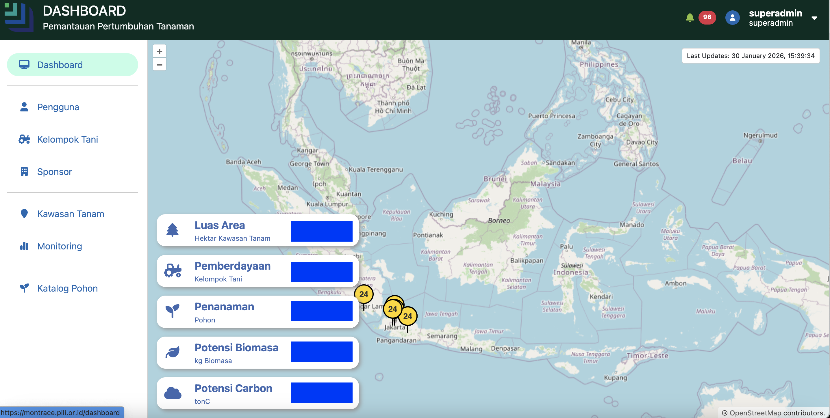
3. The GIS Intelligence Dashboard For NGOs and Sponsors, the dashboard serves as the "Command Center."
Geospatial Visualization: Utilizing GIS-based maps, stakeholders can zoom in from a national overview (Aceh to Papua) down to individual planting points.
Biodiversity Tracking: Beyond trees, the dashboard records sightings of flora and fauna, providing a holistic view of ecosystem recovery.
Real-Time Progress Tracking: Sponsors can log in at any time to see the direct impact of their funding through verified data and visual reports.
Technical Highlight: Data Integrity in Reforestation
"The core of Montrace is data integrity. By combining GPS-tagged photos from the mobile app with automated sensor data, we eliminate the risk of 'paper-based' reporting errors. This creates a 'Single Source of Truth' that builds immense trust between farmers, NGOs, and global sponsors."
The Impact Montrace has transformed reforestation from a manual, high-risk reporting process into a data-driven operation. NGOs can now manage multiple projects across the Indonesian archipelago simultaneously, while sponsors enjoy a level of transparency that was previously impossible.
Conclusion Technology is the most powerful tool we have to protect our planet. Montrace is a testament to how custom software engineering—when combined with GIS and IoT—can solve the most complex environmental challenges.